La Loire vue de l'ile Clémentine - Le vignoble à Drain - Lac de Saint Aignan de Grandlieu - Lac de Gérardmer - La Mayenne à Chenillé Changé
Localisation de la randonnée :
Informations Wikipédia sur la commune
Visualiser le circuit avec carte IGN 25K
Visualisation du circuit avec Openrunner
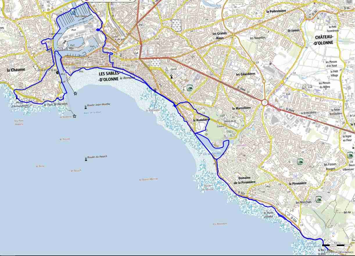
Carte de la randonnée :
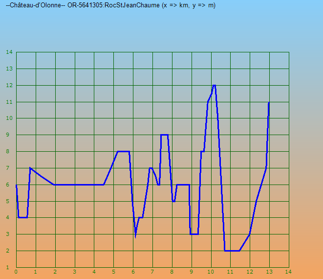
Profil de la randonnée :